

Description
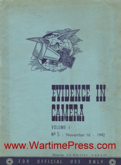
Evidence in Camera
Volume I, No. 5 · November 16, 1942
Issued by Air Ministry · A.C.A.S.(I) · For Official Use Only
36 pages scanned
- Cover illustration — A decorative pen-and-ink emblem showing a winged globe overlaid with aerial photographs, used as the masthead device for the publication.
- Samuel Pepys security cartoon — A period-style pen-and-ink illustration accompanying a 1667 Pepys diary extract, depicting robed figures in animated discussion to illustrate the theme of wartime secrecy.
- Attacks on Genoa — harbour overview — Vertical aerial photograph of Genoa’s waterfront showing destruction to the Ansaldo Fitting Out Yard and the Molo Vecchio following raids on 22/23 October 1942.
- Attacks on Genoa — Piazza De Ferrari — Vertical aerial photograph showing approximately 27 acres of devastation caused by fire and high-explosive bombs in the neighbourhood of the Piazza De Ferrari.
- Genoa — Station Brignole — Vertical aerial photograph of the Station Brignole area, with the main station building almost completely gutted and surrounding structures damaged.
- Rome/Littorio aerodrome — Vertical aerial photograph of the Rome/Littorio aerodrome situated within a distinctive meander loop of the River Tiber.
- Eugen’s new stern — Kiel dockyard — Vertical aerial photograph of the heavy cruiser Prinz Eugen lying at the entrance to the Inner Dockyard Basin at Kiel, showing her newly completed stern.
- Gneisenau and Graf Zeppelin — Gdynia — Vertical aerial photograph of Gdynia harbour showing the dismantled battle cruiser Gneisenau in a floating dock and the heavily camouflaged Graf Zeppelin carrier.
- Double record of target area — Kiel — Night aerial photograph of Kiel taken moments before bombing, with the target area illuminated and a smoke screen visible at lower left.
- Second photograph by bomb flame — Kiel — Night aerial photograph of the same Kiel target area, captured by the light of an exploding bomb revealing ground detail in dramatic contrast.
- German gliders — Go 242s at Gotha (two photographs) — Two vertical aerial photographs of the Gotha Factory Aerodrome showing both standard and engine-equipped twin-boom Go 242 freight gliders used by the Luftwaffe.
- German gliders — DFS 230s at Tobruk — Aerial photograph showing a formation of ten-seat DFS 230 gliders in flight over Tobruk, the type used during the Crete campaign.
- German gliders — Düsseldorf/Lohausen aerodrome — Aerial photograph identifying primary training gliders, intermediary gliders, and a high-performance sailplane on the aerodrome surface.
- German gliders — Ottingen aerodrome — Aerial photograph of very large gliders at Ottingen, with an Me 110 providing scale and one glider’s nose swung open for loading.
- Arnhem factory site — early construction — Vertical aerial photograph showing the initial stages of a new industrial development at Arnhem, including dredging operations for a new dock.
- Arnhem factory site — advanced construction — Vertical aerial photograph taken nearly a year later, showing the completed dock and factory buildings well advanced, believed to be an extension of the Algemeene Kunstijde Unie artificial silk works.
- Tirpitz in Ofotfjord — Vertical aerial photograph of the battleship Tirpitz underway in Ofotfjord at approximately 16 knots, with three main gun-turrets trained to port and starboard.
- Maas Class destroyers — Vertical aerial photograph of two Maas Class destroyers at high speed, believed to be acting as escorts to Tirpitz and other heavy units in Norwegian waters.
- Decoys situated round target area — Wilhelmshaven (left half) — Annotated map-and-photograph chart showing the western portion of the decoy network around Wilhelmshaven, including fire sites at Etzel and a decoy aerodrome at Ruttlerfeld.
- Decoys situated round target area — Wilhelmshaven (right half) — Continuation of the Wilhelmshaven decoy chart, showing fire sites, dummy tanks, and dummy buildings at Rustersiel and Stollhamm, with aerial inset photographs.
- Tunny fishing vessel — rods deployed — Oblique aerial photograph of a sailing tunny vessel under way with rods and lines set out, photographed from directly above.
- Tunny fishing vessel — bow view — Second aerial photograph of a tunny fishing vessel, taken from a more directly overhead angle showing the vessel’s wake and rigging.
- Hamburg/Moorfleth heavy Flak position — day photograph — Vertical aerial photograph of a double six-gun heavy anti-aircraft battery at Moorfleth, S.E. Hamburg, showing searchlight and gun emplacements with annotated reference points.
- Hamburg/Moorfleth heavy Flak position — night photograph — Night aerial photograph of the same Moorfleth battery, showing the triple searchlight in action and its light track across the ground.
- Copenhagen petrol harbour — Vertical aerial photograph of a tanker moored at the Petrol Harbour, Copenhagen, with fuel storage tanks and the causeway linking the harbour to the mainland aerodrome visible.
- Munich camouflaged squares — Vertical aerial photograph of central Munich showing two open squares near the railway station that have been painted to simulate buildings and roads as camouflage.
- New type W/T station — S.W. Germany — Vertical aerial photograph of an unusual wireless telegraphy station in south-west Germany, showing two lattice masts and associated buildings.
- IJmuiden Steel Works — two ground-level views — Two oblique ground-level photographs of the Royal Dutch Steel Works at IJmuiden, showing blast furnaces, coke ovens, and associated industrial plant, the only such facility in Holland.
- Know your ports — IJmuiden vertical view — Vertical aerial photograph of the port of IJmuiden showing the harbour entrance, dock complex, and the location of the Royal Dutch Steel Works.
- IJmuiden — oblique aerial view — Oblique aerial photograph of IJmuiden port showing the distinctive mole configuration at the harbour entrance and surrounding industrial area.
- Stavanger/Sola aerodrome — original layout — Vertical aerial photograph of the former Norwegian civil air port at Stavanger/Sola as it appeared before extensive German reconstruction.
- Stavanger/Sola aerodrome — reconstructed layout — Vertical aerial photograph taken two years later showing a new runway, lengthened old runways, new taxi-track, main hangars, and blast-wall dispersal areas added under German occupation.
- Road/rail swing bridge at Velsen (two photographs) — Two vertical aerial photographs of the swing bridge over the North Sea Canal at Velsen, showing the original configuration and modifications to adapt it for combined road and rail use with new ramps.
- Calais railway facilities — Vertical aerial photograph of Calais annotated to show the Fontinettes Marshalling Yard, Town Marshalling Yard, Locomotive Depot, and the complex rail/road junction.
- Problem picture — Vertical aerial photograph of an unidentified rural scene with evenly spaced structures along a road, posed as a recognition challenge with the previous issue’s answer (IJmuiden moles) provided below.